|
northwest
Missouri; southwest Iowa; northeast Kansas; southeast Nebraska
From
the look-out point of the Waubonsie State Park in Fremont County, Iowa,
you can see the above four states.
|
|
|
|
|
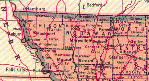 |
Atchison
County, Missouri is bordered on the east by Nodaway County and on
the south by Holt County, Missouri |
|
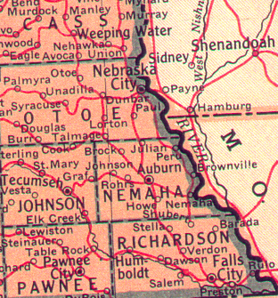 |
Otoe and Nemaha Counties,
Nebraska are across the Missouri River to the west of Atchison County,
Missouri |
|
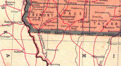 |
Fremont and Page Counties
in Iowa border Atchison County, Missouri to the north. |
|
| |
| |
| These maps are
from the 1950 Edition of the Compton's Pictured Encyclopedia and
Fact-Index, volumes I, K, N, and M. The actual maps
say that they were "Copyright by C.S. Hammond & Co., N.Y."
but do not have a date on them. |
| |